.DID YOU KNOW?
Burnham’s new information points give information about a range of local history:
1. When did a great flood stretch from Bunham-On-Sea to Glastonbury Tor?
2. When did the First Lord of the Admiralty row a boat across Burnham’s Marine Lake?
3. How high is the high lighthouse in Berrow Road?
4. Why is there a sculpted masterpiece in Burnham’s St Andrew’s Church?
Answers: (1) 1607 (2) 16 May 1931 (3) 99ft (4) It was brought to Burnham from Westminster Abbey in 1827.
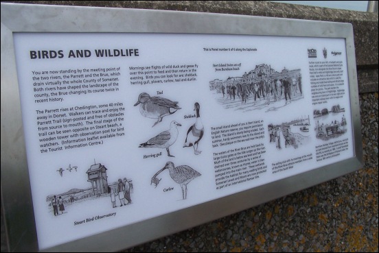
Walkers along Burnham’s seafront can now quite literally step back in time following this week’s launch of several new information points which provide historical information about the town.
Six new information points were officially unveiled by town councillor Neville Jones and Burnham and Highbridge Regeneration Partnership Chairman Mike Murphy, pictured above, on Monday.
“They celebrate our town’s heritage,” said Cllr Jones. “Each point provides background information about the town’s colourful history, including our lighthouses, life-saving services and local wildlife.”
“And they also teach young people about important local history that they wouldn’t be told in school.”
Cllr Jones has led the project and written the content for each of the points while Mr Murphy’s group has provided the funding, along with the town council and district council. Cindy Tee of the town’s tourist information centre has also been heavily involved in the project.
Further panels are set to be unveiled in Highbridge during the coming months, giving further information about the area’s history.