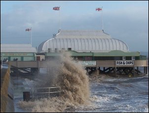
The Bristol Channel was placed on a Flood Watch by the Environment Agency on Sunday (March 9th) as the area braced itself for storm-force winds and high seas.
A large area of the Bristol Channel – from Porlock to Avonmouth, including Burnham – was on a precautionary flood watch as the threat of damaging storms loomed large.
Forecasters are warning that the Burnham area will be struck by powerful 70mph gales which have the potential to cause damage and uproot trees later in the early hours of Monday.
Sunday night’s 11.1 metre tide passed without incident at 8.15pm and all eyes are on Monday morning’s 11.3 metre tide which is due to 8.32am.
The Environment Agency has not ruled out the risk of flooding on either the morning tide or the 8.51pm tide on Monday evening.
Environment Agency spokesman Paul Gainey told Burnham-On-Sea.com: “We are closely monitoring this storm and further flood watches and updates will be given for the Burnham area as the storm develops.”
The storm-force winds are predicted to hit early on Monday as squally rain crosses the UK. The high winds are expected to ease during the day but increase again in the afternoon and evening.
Burnham-On-Sea.com will have regular updates on this developing story.
RELATED LINKS:
![]() Flood advice pages for Burnham
Flood advice pages for Burnham
![]() 1981 storm remembered
1981 storm remembered
![]() Storms and huge waves batter Burnham in 2006
Storms and huge waves batter Burnham in 2006
![]() Tide times for Burnham-On-Sea
Tide times for Burnham-On-Sea


