The Met Office has issued four days of weather warnings as heavy rain and strong winds are set to hit the Burnham-On-Sea area this week.
The storms are affecting the region today and the rain becoming particularly heavy at times on Tuesday before clearing during Wednesday morning.
However, a separate developing frontal system is expected to bring another period of persistent, and at times heavy, rain later on Thursday and into Friday.
 “The public should be aware of the risk of localised flooding, perhaps exacerbated by fallen leaves blocking drainage courses,” said a spokesman.
“An active frontal system associated with an Atlantic depression pushed in from the west late on Monday. It will become slow-moving, allowing pulses of heavy and sometimes thundery rain to spread northwards across south west England and South Wales before finally clearing northeastwards.”
“Precise timings of these periods of heavy rain remain uncertain, and there are also likely to be some drier intervals within this warning period.”
“The strong southerly winds, reaching gale force in places, will enhance rainfall over south-facing slopes and hills, where totals of more than 60mm in 36 hours are likely. 20-40 mm will fall more widely. The rainfall is likely to cause some minor flooding from either surface water or from rivers.”
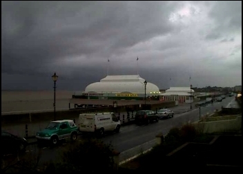
Pictured: A car splashing through surface water in Burnham’s Berrow Road and, above, the dark clouds seen on the Burnham-On-Sea webcam