Burnham-On-Sea and Highbridge residents could see safer walking or cycling facilities introduced as part of a new ten-year plan for the town.
Somerset Council has published its Burnham-On-Sea and Highbridge local cycling and walking infrastructure plan (LCWIP), which assesses the two towns’ existing active travel network and identifies where improvements are needed.
Four routes across the town have been prioritised for future investment as the council seeks to encourage greener transport, cutting congestion and pollution in the face of local housing growth, as reported here.
As part of the plan, improvements will be made at the eastern edge of Burnham-On-Sea, making it easier for people living on the residential streets to walk to the local Tesco store, Highbridge Medical Centre, and the King Alfred School.
LCWIPs are ten-year plans which focus on improving walking and cycling networks across major settlements, making it easier for people to travel to work, school or other local facilities without relying on the private car.
The plans have been developed through consultation with the council’s local community networks (which have been driving forward improvements in rural areas), cycling charities and campaign groups.
Having these plans in place makes it easier for the council to secure funding for identified improvements – either by applying for grants from central government, or by negotiating financial contributions from new housing developments.
The council has already published a number of plans for other settlements in Somerset – including Bridgwater, Frome, Taunton and Yeovil, as well as a broader plan for the former Mendip area.
In each case, the LCWIP is designed to be an “evolving plan”, with the chosen improvements being subject to change depending upon the views of local residents or the availability of funding.
Four routes prioritised over the coming decade:
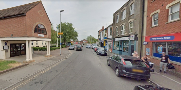
The LCWIP identifies a “core walking zone” within both town centres which should be “a focus for infrastructure improvements to benefit walking and wheeling journeys”.
These may include the implementation of 20mph sped limits, redesigning key junctions to make them safer (such as the Clock roundabout in Highbridge), providing new or wider pavements (such as on the B3139 Market Street) and improving connections with other forms of transport (such as the entrance to Highbridge and Burnham railway station).
Of the four routes prioritised within the LCWIP, three feed into or terminate at this town centre zone, ensuring that local businesses and facilities remain the focal point as new housing is delivered further and further afield.
The four identified routes are:

Route 1, from Berrow to Burnham-On-Sea town centre
Route 2, from Burnham-On-Sea town centre to Highbridge town centre
Route 3, from the B3140 Love Lane to Highbridge town centre
Route 4, from Highbridge town centre to Isleport Business Park and the Isleport Grove development.
Will these routes support new housing in the town?
These routes have been identified in part to encourage sustainable journeys from both existing housing developments and new sites which will come forward for delivery in the next few years.
Route 4 is designed to make it easier for residents of the Isleport Grove estate (comprising 248 homes and a community hub, being constructed by Countryside Partnerships) to access work and onward travel by rail.
Route 3’s improvements currently end at the top of Love Lane, but extensions could be delivered as the plan evolves to provide connections with a mooted development of 2,000 homes further to the north.
In each case, the LCWIP is designed to provide connections between major developments and key services – including:
Local shops and businesses
Leisure facilities (including Burnham Swim and Sports Academy)
Local schools (including the King Alfred School)
Health facilities (including Highbridge Medical Centre)
The seafront and associated businesses and attractions
What is proposed along the eastern edge of Burnham-On-Sea?
Route 3 runs along the predominantly residential eastern edge of Burnham-On-Sea, from the junction of Stoddens Lane down Love Lane, the Frank Foley Parkway, and Pepperall Road, where it joins the B3139 Burnham Road.
The northernmost section of the route has a shared used cycle-path, which begins just south of the Stoddens Lane junction and runs along the western side of the road as far as the junction with Ramsay Way.
From there, cyclists have to ride on the road (which has a 30mph speed limit) while pedestrians have to rely on the grassy verge, which narrows north of the recently resurfaced Love Lane roundabout with limited opportunities for crossing from one side to another.
At the roundabout, the path resumes with a signal-controlled crossing over the B3140 Love Lane (near the Tesco supermarket) and a wider, demarcated pedestrian and cycle-path which runs along the Frank Foley Parkway.
This path runs along the length of this road (named after Second World War hero Frank Foley, who was born in Highbridge), crossing over both ends of Ben Travers Way and the Worston roundabout.
Both ends of Ben Travers Way are “very wide and flared, enabling drivers to make turning manoeuvres at higher speeds” and increasing the distance those crossing have to travel.
The final section along Pepperall Road to Burnham Road (which includes the Highbridge Medical Centre off Alfred Court) is a conventional pavement, with cyclists “having to mix with the heavy traffic flows”.
To rectify these issues, the plan recommends the following improvements:
- Construct continuous cycle tracks along Love Lane (to the Tesco roundabout), the Frank Foley Parkway and Pepperall Road . This will be a mixture of new cycle tracks and bringing the existing paths up to modern standards where needed, which “would require a redesign of the road layout in many places”
- Provide new and improved crossings at or close to the major junctions to support safe walking, wheeling and cycling journeys, such as at the Tesco roundabout and the junction of Burnham Road and Pepperall Road
- Construct a cycle track on the section of Burnham Road between Pepperall Road and Morland Road, to link into ‘quietways’ for cycling through the Morland Estate (towards Apex Park)
What is planned for the other three routes?
The LCWIP identifies a number of improvements for each of the four designated routes.
Route 1, which runs along the B3140 Berrow Road between Brent Road and Victoria Road, currently has high traffic flows (especially around the summer due to the numerous holiday parks nearby), narrow footways and “no dedicated cycle infrastructure”.
A study was carried out in 2017 by Greenways and Cycle Routes (which has been assisting with the delivery of the Strawberry Line multi-user path), which recommended creating a ‘greenway’ west of Berrow Road, upgrading existing public rights of way.
Phase one of this proposal received the backing of local parish councils and secured planning permission from Sedgemoor District Council in 2018 – but the improvements were not implemented and this permission has now lapsed.
Somerset Council will consider whether this proposal could be revived, and also intends to redesign several junctions leading onto Berrow Road, exploring whether zebra crossings could be delivered at key locations.
On Route 2, the council intends to construct a new cycle track along Marine Drive and a section of Burnham Road between Marine Drive and North Avenue, which will link up with the existing routes through Apex Park and the Stop Line Way towards the seafront (part of National Cycle Network route 33).
New 20mph speed limits could also be implemented along this route, along with other traffic calming measures, with the active travel route along the former railway line to Burnham town centre also being upgraded with new lighting and improved surfacing.
In the future, a one-way system could be implemented on St. Andrew’s Road, and new crossings could be delivered on Burnham Road and Oxford Street.
On Route 4, improved crossings will be provided on the roundabouts at either end of Bennett Road, with cycle tracks being provided along the length of this road (which serves the eponymous industrial estate).
The council will also look at widening the footway along the B3139 to provide safer routes to the railway station, where officers intend to deliver step-free access as part of the council’s local transport plan.
Is there any funding available for this?
The LCWIP does not directly commit funding to any of the four routes – but it will prove instrumental in the coming years to securing grant funding or contributions from developers.
Active Travel England confirmed in November 2024 that the council would receive an additional allocation of £684,781 towards active travel improvements across Somerset, on top of funding previously allocated to deliver ‘missing links’ in Yeovil town centre and enhancing the route along the A39 between Carhampton and Minehead via Dunster.
This latest grant must be committed to delivering schemes by the end of March 2026, and construction work must be finished by March 2027, notes the Local Democracy Reporting Service.
You can access and comment on the Local Cycling and Walking Infrastructure Plans here: Local Cycling and Walking Infrastructure Plans and view the detailed Burnham and Highbridge plan here.