More photos have emerged of a tornado-like funnel cloud spotted hovering over Burnham-On-Sea on Saturday morning (August 5th).
The cone-shaped cloud was photographed by several Burnham-On-Sea.com readers, as featured here.
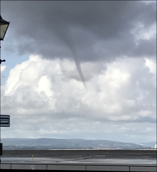
Raymond Kear took this photo of the cloud formation from The Oaktree looking towards Burnham.
And holidaymaker Donna Preston photographed it over Stert Island as it passed Burnham-On-Sea, pictured below.
Donna told Burnham-On-Sea.com: “This photo was taken at 10.23am coming inland from Burnham.”
“It was such an incredible sight. My fiancé Wayne and I watched it as it blew inland and was clearly twisting in the sky.”
According to the Met Office, funnel clouds are extending, spinning fingers of cloud that reach towards the ground or surface of the sea but don’t touch it.
Upon reaching the ground, the cloud would become a tornado, which can produce very strong winds and potentially cause damage.
Funnel clouds are often associated with extreme weather conditions such as rain, hail and thunder.