Origin of the name Highbridge
Find out about the town’s historic background
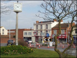 Several have speculated as to how the name into being and just how long it has been used in its present form. Many early documents refer to “Huish juxta Pontem” – “Homestead near the Bridge”.
One document however, “The Downend Review” of 1930, refers to court proceedings in 1280 when it is written “certain tenements at Huish by Highbridge”. The bridge to which this refers still exists, a few feet from the new roundabout junction with Market Street and the A38 on the Huntspill side.
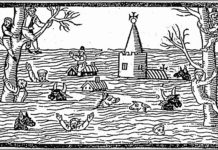
Some form of bridge has probably existed from at least Saxon times, but when the little stone hump-back bridge came into being has not yet been established. The river Brue [known at one time as “The Ivel”] has been part of the Somerset levels drainage system since time immemorial as have the rivers Axe and Parret. The levels were at one time under water, forming an inlet from the Bristol Channel, probably reaching inland to beyond Glastonbury. These rivers and their tributaries were used by the Glastonbury Monks as their main mode transportation between the Brent Level villages and hamlets and possibly further afield.
A new geology of the Brue estuary formed as the waters receded, leaving two points of land that our bridge links. When one examines the lie of the land, it seems that the distance between the river banks where the foundations were dug, has hardly altered at all although now it is almost entirely blocked. Over the years two further bridges were constructed up stream, one known as New Bridge and the second as Bason Bridge. The New Bridge exists about half way between the High Bridge and the Bason Bridge, and crosses the Brue from Newbridge Drove to Newbridge House adjoining the old railway bridge carrying the Somerset & Dorset Joint Railway line.
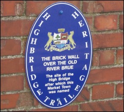 Why the name “High” was given to our bridge can only be speculation; that it was a hump-backed bridge is not in doubt, so did it earn its name from its construction to allow masted or highly laden vessels the freeway navigation of the river? These vessels would have been of quite lesser proportions than the ones we know of today; probably a barge-like structure. The nomenclature seems hardly likely to have been given due to its position in relationship to other bridges, when one considers that the bridge is downstream from whatever others existed.
Up to the 20th century the A38 or The Turnpike as it was previously known by, was the main route over the river which Daniel Defoe in his descriptive book on Somerset, defined as the “Lower Way”, not being very clear though as to what comprised the “Upper Way”, he was more forthcoming when stating that the latter was by far the safest.
The name lent itself to the community that grew up around it, although Huish was in fact the name of a homestead area along the Highbridge to Burnham Road, where the small bypass was built in recent years; about 100 yards or so past the cemetery on the same side and probably more recognisable as Sandyway Farm or Sand Way Farm as it was once known and included land which was part of Clarke’s shoe factory.
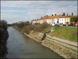 The Brue and the Axe became joined at their upper reaches by man’s attempt to cure the almost never-ending flooding of the lower reaches of the Axe. The so diverted waters became almost torrential; the new force opening up the Brue’s confluence with the River Parret, subsequently being seen as a prospect for enterprise, and somewhat in keeping with similar national projects a canal was constructed along the Brue’s length. The river’s new course bypassed the High Bridge and incorporated a large sluice gate at its new mouth, specially designed to control the ebb and flow of the tidal waters, and was accompanied by the present iron girder construction over the new cut.
For several years the new canal provided good service for small cargo ships to and from Glastonbury but proper provision had not been made for the maintenance of the canal and it soon became apparent that its bed was not leak-proof and so with collapsing banks, it became un-navigable for those cargo ships. In the meantime the old river bed which provided docking facilities in the form of a wharf, from the Olde Bridge to where it joined the new cut, had increased its activities, in company with the new Somerset & Dorset Joint Railway that had extended its line from Highbridge to Burnham and had constructed a siding area at the wharf for import and export.
This provided much work for 19th and 20th century mariners, many tradesmen set up shop. The Markets at Highbridge, already a communal meeting place for country folk from nearby places such as Edithmead, South and East Brent, Vole, Mark, Watchfield, Huntspill and many others too numerous to mention, became almost comparable with city markets. Employment was plentiful and was of course a good source of income for the Highbridge coffers, augmented by the S&DJR who provided nationwide land links for both passengers and cargo. These activities saw service through two world wars but it gradually became too expensive to keep alive, passengers from shipping had long ceased with silting being once again the main culprit and the new road transport facilities increasing. As the shipping fell off, so did the rail traffic despite the market facilities of Highbridge, until, in the mid 60s, the railway closed as had the wharf several years previously.
Further Reading of Robin Atthill’s “The Somerset and Dorset Railway” – his new edition, provides a wealth of information and interest on Highbridge’s connections with the outside world.
This page was compiled for Burnham-On-Sea.com by Roy Cox.

