Strong winds from Storm Eunice left power cuts and disruption in the Burnham-On-Sea area on Friday.
The M5 northbound between Bridgwater and Burnham was briefly closed due to a vehicle overturning at around 12.15pm.
A power cut also left thousands of homes in the Burnham and Berrow area without electricity during this morning, with Western Power Distribution reporting a very busy day for their crews.
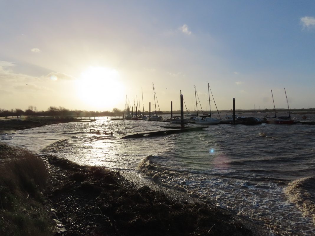
Large waves crashed onto Burnham-On-Sea’s sea wall at high tide, sending plumes of spray onto the seafront this morning (Friday) as Storm Eunice arrived with strong onshore winds, but fortunately there was no flooding.
The town’s flood gates have been closed by the Environment Agency to avoid flooding.
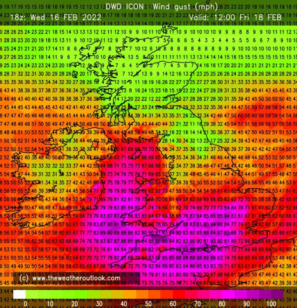
The Met Office had a rare red weather warning in force as it warned winds “could be in excess of 90mph” and said flying debris is a danger.
The Environment Agency issued a flood warning for the coastline between Burnham-On-Sea and Berrow, saying flooding is possible for two to three hours either side of the high tide. Attention moves to the next high tide this evening at 8.22pm Burnham-On-Sea tide times.
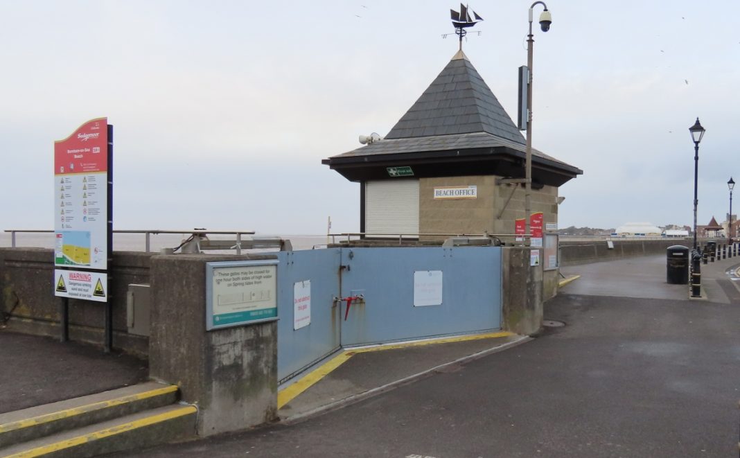
Flood gates have been closed by the agency at the top of Burnham jetty, at Maddock’s Slade, and at the Sailing Club to try and reduce the risk of flooding.
The Met Office warns that strong westerly onshore winds will whip up rough storm waves and could create a tidal surge along the Bristol Channel. Gusts of up to 90mph are forecast to peak in Burnham-On-Sea during the late morning.
Schools will be closed for the day, and rubbish and recycling services will also be closed, and several shops and businesses are closing as a safety precuation. Burnham’s Chatterbox, The Front Parlour and Coffee, Cake and Curtains are among several businesses closing for the day, while Burnham’s Ritz Social Club says it will close at least until 3pm.
Met Office Chief Meteorologist Frank Saunders says: “Storm Eunice will bring damaging gusts in what could be one of the most impactful storms to affect southern parts of the UK for a few years.”
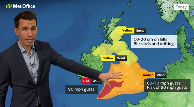
“The red warning area indicates a significant danger to life as extremely strong winds provide the potential for damage to structures and flying debris.”
Frank adds: “Although the most exposed coastal areas in the south and west could see gusts in excess of 90mph, winds will remain notably strong further inland, with gusts of between 70-80mph for most within the amber warning area.”
Katharine Smith, Environment Agency Flood Duty Manager, adds: “Strong winds could bring coastal flooding to parts of the west, southwest and south coast of England, as well as the tidal River Severn, on Friday morning. This is due to Storm Eunice resulting in high waves and potential storm surge coinciding with the start of a period of spring tides.”
National Highways Head of Road Safety, Jeremy Phillips, said: “We’re encouraging drivers to check the latest weather and travel conditions before setting off on journeys and consider if their journey is necessary and can be delayed until conditions improve. If you do intend to travel, then plan your trip and take extra care, allowing more time for your journey.
“In high winds, there’s a particular risk to lorries, caravans and motorbikes so we’d advise drivers of these vehicles to slow down.
“Drivers of other vehicles should be aware of sudden gusts of wind which can affect handling and braking, and give high-sided vehicles, caravans, and motorbikes plenty of space. In the event of persistent high winds we may need to close bridges to traffic for a period, so please be alert for warnings of closures and follow signed diversion routes.”
Gary Bywater, Area Incident Duty Manager for the Environment Agency, says: “Strong winds from Storm Eunice could cause a storm surge and large waves, bringing a risk of flooding to homes and businesses along the Severn and Wye estuaries.”
“We’re seeking to give early warning to communities to prepare. We will issue flood warnings if necessary and we have teams out on the ground taking action to reduce the impact of any possible flooding.”
A yellow weather warning for more strong winds for the Burnham-On-Sea area will be in force on Saturday.
You can check your flood risk, sign up for free flood warnings and keep up to date with the latest situation here or call Floodline on 0345 988 1188 for the latest flood updates.
Burnham-On-Sea weather forecast