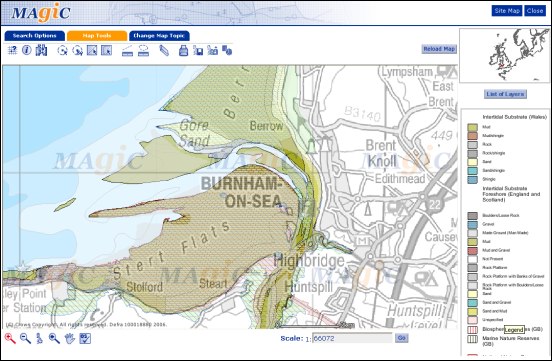
A unique view of Burnham-On-Sea’s ever-changing coastline is shown in a brand new online atlas launched this week.
The government-run service lets Web users find out more about the materials that make up the UK’s coastline.
Called MAGIC (Multi-Agency Geographic Information for the Countryside), the site will help government agencies watch for environmental changes around the UK and also assess the affects of serious marine incidents, such as major oil spills.
Burnham’s coastline is shown as being dominated by mud, sand and shingle – and users can zoom into the maps to pin-point detailed locations.
Since the data is being constantly updated, the service is likely to become a valuable resource for environmentalists watching for any effects that dredging in the Bristol Channel may have.
The service has cost £200,000 to develop over two years and has been funded by several private and public sector organisations led by the Maritime and Coastguard Agency and DEFRA.
A spokesman said: “This will be an important tool for improving how the UK plans to manage its precious natural coastal and marine resources.”
RELATED LINKS:


