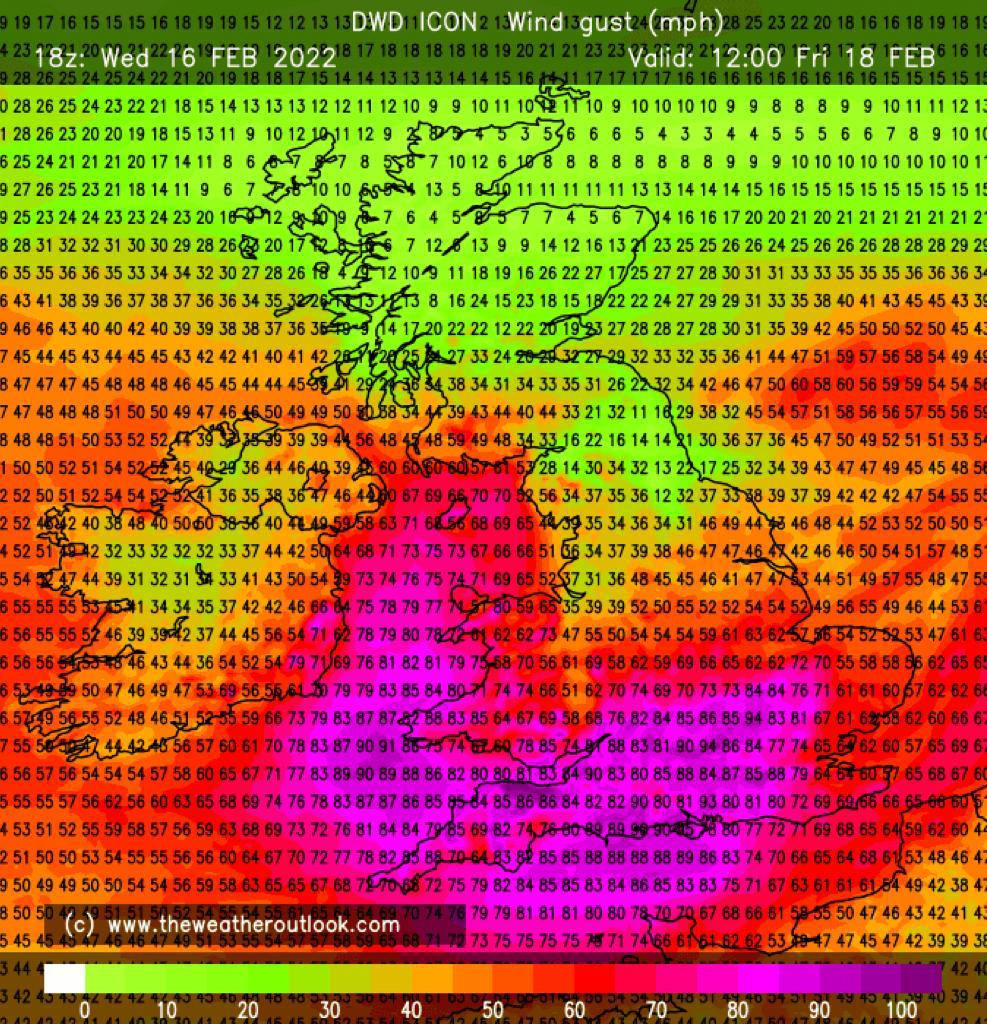
The Met Office has issued a rare red weather warning for high winds gusting up to 90mph as Storm Eunice is forecast to sweep through the Burnham-On-Sea area on Friday (February 18th).
The Met Office warns that strong westerly winds will whip up storm waves and could create a tidal surge in the Bristol Channel.
Gusts of up to 90mph are forecast to peak in the Burnham-On-Sea area during the morning until mid-afternoon, with the high tides in Burnham-On-Sea set for 7.59am and 8.22pm.
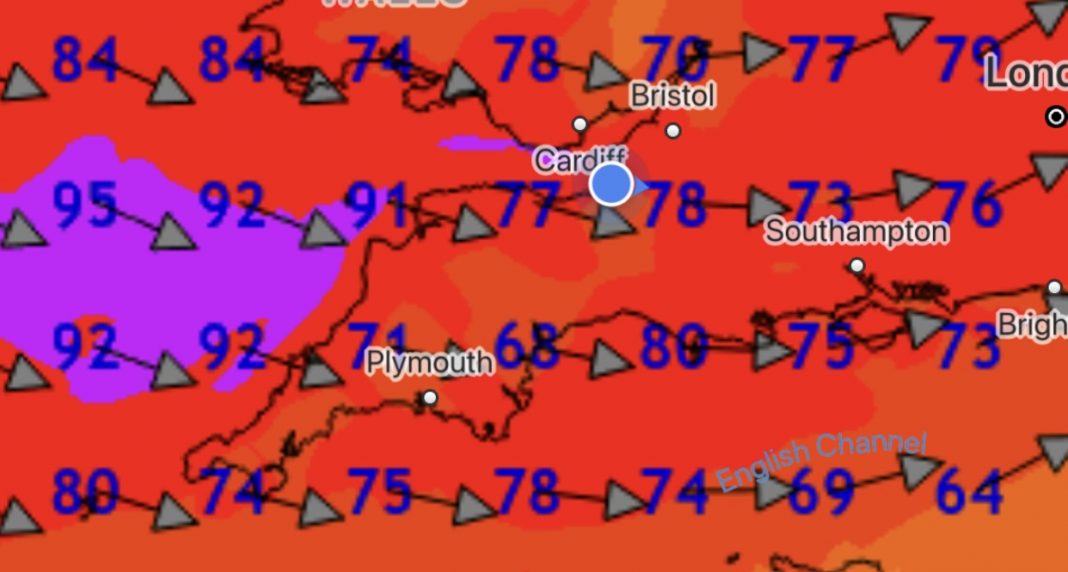
A Met Office spokesman says: “Extremely strong west to southwesterly winds will develop over southwest England and south Wales early on Friday.”
”Widespread inland gusts of 70-80 mph are likely and up to around 90 mph near some coasts, with dangerous conditions on beaches and seafronts. Winds are expected to ease from the west during the late morning.”
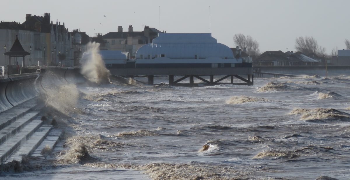
The Environment Agency has also advised that there is an increased risk of coastal flooding, although it says the main area of concern is further north up the Severn Estuary where low-lying may flood.
Gary Bywater, Area Incident Duty Manager for the Environment Agency, says: “Strong winds from Storm Eunice could cause a storm surge and large waves, bringing a risk of flooding to homes and businesses along the Severn and Wye estuaries.”
“We’re seeking to give early warning to communities to prepare. We will issue flood warnings if necessary and we have teams out on the ground taking action to reduce the impact of any possible flooding.”
You can check your flood risk, sign up for free flood warnings and keep up to date with the latest situation here or call Floodline on 0345 988 1188 for the latest flood updates.
Burnham-On-Sea weather forecast