The scale of Somerset’s floods is illustrated in these new aerial photos and video captured by a Burnham-On-Sea microlight enthusiast.
Jeff Thomas got a ‘birds-eye view’ of the ongoing flooding when he flew in his microlight over the River Parrett to Burrowbridge.
Jeff told Burnham-On-Sea.com: “The video clip that begins by looking south towards Taunton then swings across the Somerset floods from south to east to North finally showing the floods around Westonzoyland with Bridgwater in the distance.”
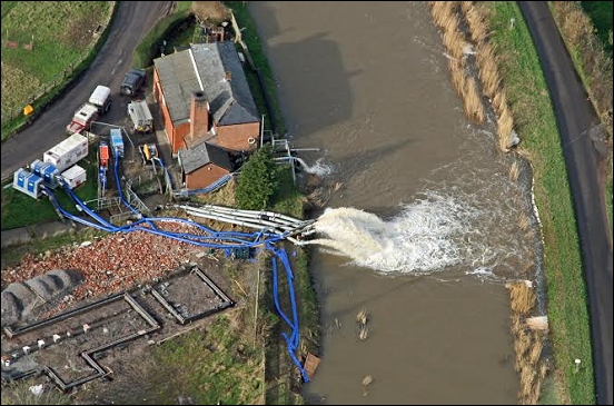
“Clearly the floods are more extensive than they have been in previous years with many acres of farmland under water. These pictures were taken from an altitude of around two thousand feet, and to get good pictures they were taken with the aircraft window open which was very cold and rather windy. The Environment Agency’s pumping station is shown where the pumps are working flat out.”
Latest official figures reveal that more than 43 sq miles (27,000 acres) of productive farmland has been flooded across the county over the past month.