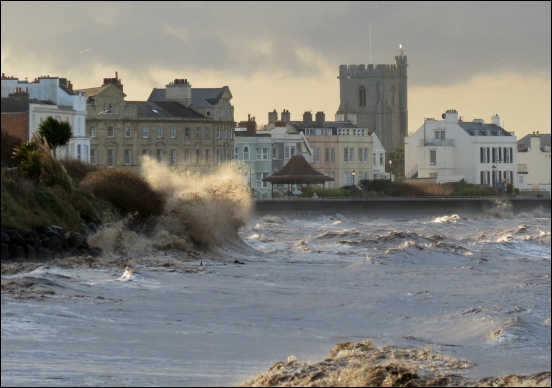
Burnham-On-Sea residents have this week been reassured by the Environment Agency that the town’s sea defences are ‘designed to protect against a 1-in-200 year flood event’ following an alarming map being issued by a climate change group.
Parts of the Somerset coastline could become partly submerged by rising sea levels over the next 30 years say climate experts from Climate Central who have created a map of the county showing the areas flooded by the year 2050.
The map, called the Coastal Risk Screening Tool, indicates areas around Burnham, Weston-super-Mare, Clevedon, Minehead and Bridgwater, could be at a risk of being affected due to rising sea levels.
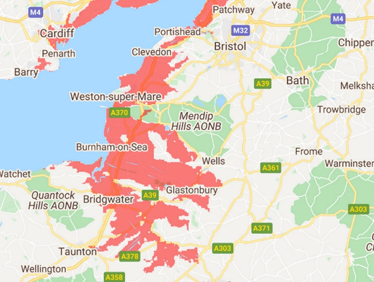
However, Climate Central cautions: “These maps incorporate big datasets, which always include some error. These maps should be regarded as screening tools to identify places that may require deeper investigation of risk.”
It adds the maps have been based on “global-scale datasets for elevation, tides and coastal flood likelihoods” and it says “imperfect data are used”.
Environment Agency responds to concerns
Burnham-On-Sea.com has approached the Environment Agency this week for its response on the map.
A spokeswoman tells us: “We’re already seeing evidence of a changing climate, with more frequent and more extreme flooding and coastal erosion. These changes mean an increased risk to communities, the environment, and infrastructure.”
“In the 2020 Budget the Government doubled its investment in flood and coastal scheme construction in England by committing a record £5.2bn between 2021 and 2027. This long-term commitment will better protect 336,000 properties, including homes, businesses and hospitals.”
“For every £1 spent improving protection from flooding and coastal erosion, we avoid around £5 of property damages. This long-term commitment will make homes, businesses and infrastructure more resilient to the increasing impacts of climate change.”
The spokeswoman adds: “The coastal flood defence scheme in Burnham-On-Sea continues to reduce the risk of flooding to 10,000 properties and businesses.”
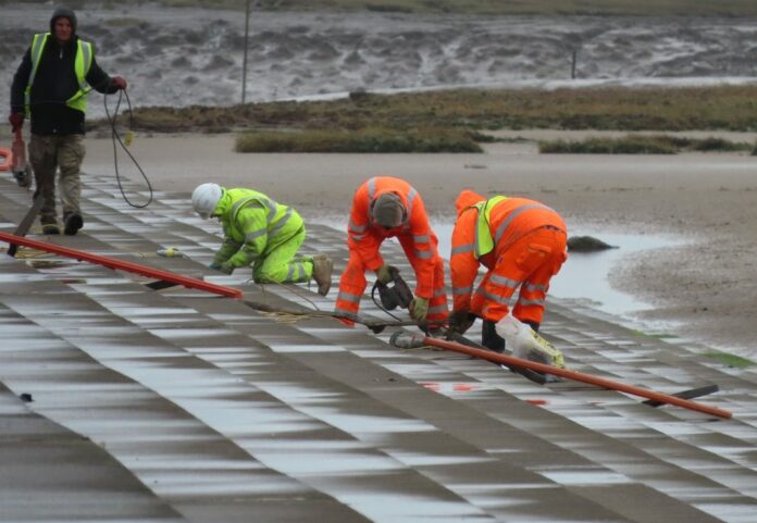
The sea wall is currently being repaired, as we reported here, pictured below, and the spokeswoman added: “It is designed to protect against a 1-in-200 year flood event.”
“We encourage people to check their flood risk and know what action to take in the event of a flood.”